
Willcox Playa
Introduction
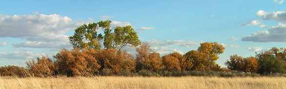
Willcox Playa doesn’t draw many crowds. Visitors reviews vary wildly, from “bleak and inhospitable” where “dust devils slither along,” to “teeming with life” and “dawns break cold, clear and full of life.” Even in Arizona, known for its stark contrasts, this flat expanse of valley floor is a landscape of radical extremes. But many visitors to Willcox Playa find its natural history surprisingly rich, an extraordinary geologic setting that supports hundreds of bird and other species.
 Geologic History
The southern half of Arizona lies in the Basin and Range Geologic Province, with north- and northeast-trending mountain chains and intervening desert valleys. Most, but not all, of these valleys have drainage connections to the Colorado River through its many branching tributaries in southern and central Arizona. However, Willcox Playa is an interior-draining basin—the largest in the state. Such “graben” valley landforms developed in the Southwest over the past 20 million years as the earth’s crust has been tectonically pulled apart. This same tectonic extensional process is occurring in east Africa’s Great Rift Valley, producing similar interior-draining basins there. Uplifting of the Sierra Nevada range and other western ranges created hundreds of north-trending mountain ranges with intervening valleys throughout Nevada, western Utah, southeastern California, New Mexico, Texas, and northern Mexico. These ranges now block moist Pacific airflow, creating a “rain shadow” desert in the Southwest.
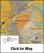
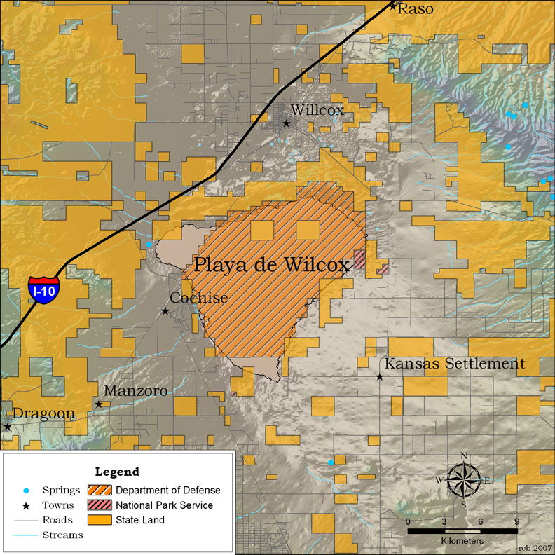
Willcox Playa is roughly triangular at its core, and nearly 8 miles wide by 10 miles long (approximately 40 mi2 in core area, nearly 200 mi2 in overall area), and is surrounded by mountain ranges: the Pinaleño Mountains with Mount Graham and its conspicuous observatory lie to the north; the Dos Cabezas range lies to the east; the Chiricahuas lie to the southeast; the Dragoons lie to the southwest; the Little Dragoons lie to the west; and the Galiuros range lies to the northwest. Clay, the finest suspended sediments, travels farthest in streams, and as the drainage terminus for many of these adjacent mountain ranges, it is no surprise to find that Willcox Playa is floored with white silt and clay. The playa is well known for its winds and, as is typical of many southwestern playas, there are relatively large sand dunes around its margins, particularly on the windward east and northeast sides. Many of these dunes are somewhat stabilized by grasses and shrubs.
Many playas in the Great Basin were covered by vast expanses of water during the previous glacial phases, but only the Great Salt Lake remains as a remnant of Pleistocene times. In Arizona, as elsewhere in the Basin and Range Province, these ice age lakes have dried up. About 15,000 years ago in Willcox Playa, Lake Cochise reached a maximum depth of 46 feet and covered 140 square miles, maintained by the relatively cool, moist Pleistocene climate. Currently, with a mean annual rainfall of 18.5 inches per year and a mean annual temperature of 90oF, the modern playa can support only shallow, ephemeral ponds that form after heavy rains or snows. The most recent high lake level occurred about 9,000 years ago.
Ecological Importance
Willcox Playa is a sparsely-vegetated desert grassland, strongly dominated by alkalai sacaton and saltgrass, with some cover of little bluestem and other grasses. Shrub cover increases towards the periphery, with saltbushes, mesquites and non-native tamarisk. Scattered Fremont cottonwood and Goodding’s willow grow in or along the network of ditches that have been built to drain sections of the playa over the past century. The playa also supports a population of a rare plant species, the Chiricahua Mountain tansy-aster.
Willcox Playa is best known to the public for its wintering population of sandhill cranes that migrate to the playa in large numbers, particularly in wet winters. It is not unusual to see several thousand cranes in winter at the power plant ponds viewing area on the southwest side of the playa, or at the Arizona Game and Fish Department’s 600-acre Wildlife Area on the southeast side. The cranes feed and court, but after February migrate to their summer breeding grounds in the northern Great Plains.
Willcox Playa also supports other large waterbirds, including white-faced ibis, as well as many raptors, including several wintering hawks. Red-tailed hawks, northern Harriers, Harris’s hawks, prairie falcons, bald and golden eagles, as well as caracaras, great horned owls, and burrowing owls all make use of this surprisingly diverse habitat. The shrubs and trees on the periphery of the playa support migrating northern flickers, white-necked ravens, and many songbird species. Sometimes more than 10,000 birds will congregate at the playa.
An array of other vertebrates also live on and around Willcox Playa. Surveys have revealed several distinctive amphibians and reptiles species, including Chiricahua and plains leopard frogs as well as Texas horned lizards. Mammals include desert cottontails, black-tailed jackrabbits, kangaroo rats, other desert herbivorous rodents, and collared peccaries.
Less well known is the extraordinary diversity of tiger beetles found at Willcox Playa—one of the highest concentrations in a single small area in the United States. These beautiful, metallic, day-flying predators abound in the grass and open patches of soil near water (11 species) and in the uplands (6 species) around the playa. Several endemic species exist there, including the Willcox Nevada tiger beetle and the Sulphur Springs Williston’s tiger beetle. The high diversity of tiger beetles on and around the playa may be related to the quality of the habitat and the proximity of the site to northern Mexico, which has a great abundance of tiger beetle species.
Human History
Some stone artifacts discovered in the Willcox Playa area, originally believed to be associated with the most recent high levels of Lake Cochise and as much as 9,000 years old, are now thought to be much younger. There is sparse evidence of Middle Archaic occupation, but much more widespread evidence of late Archaic settlement.
Used as a military bombing range, Willcox Playa contains undetonated ordinance; therefore much of the area is closed to visitation.
With 356 days of sunshine per year, Willcox Playa has been identified as a potential solar energy production site. Lands peripheral to the playa are used for livestock grazing.
Conservation
Willcox Playa is managed for multiple purposes. The Arizona Game and Fish Department Wildlife Area is managed to support wildlife habitat in perpetuity, and to maintain opportunities for public hunting and other forms of wildlife-oriented recreation.
Contributing Writers
Dr. Lawrence E. Stevens and Jeri Ledbetter.
Photo © Dr. Lawrence E. Stevens
Links
Visitation
http://www.azgfd.gov/outdoor_recreation/wildlife_area_wilcox_playa.shtml
http://www.wingsoverwillcox.com/
Maps
http://www.azgfd.gov/images/outdoor_recreation/map_willcox.gif
http://skywalker.cochise.edu/wellerr/geology-SEAZ/willcox/maps/topo1.htm
Water Resources
http://ag.arizona.edu/azaqua/watershed/wilcox.html http://data.afws.org/sui/River_WS_WillcoxPlaya.aspx
Historical Information
http://links.jstor.org/sici?sici=0093-4690(199022)17%3A2%3C163%3ATGAPPO%3E2.0.CO%3B2-Z
Bibliography
- Cooper, J.R. 1960, Reconnaissance map of the Willcox, Fisher Hills, Cochise, and Dos Cabezas quadrangles, Cochise and Graham Counties, Arizona: USGS Min. Inv. Field Studies Map MF-231.
- Erickson, R. 1988, Geology of the Willcox north quadrangle and the southernmost Greasewood Mountain quadrangle, Arizona: Ariz. Geol. Survey Misc. Map MM-88-B, 6 p., 1:24,000.
- Long, A. 1966, Late Pleistocene and recent chronologies of playa lakes in Arizona and New Mexico: Ph.D., University of Arizona.
- Martin, P.S. 1963. Geoghronology of Pluvial Lake Cochise, southern Arizona. II. Pollen analysis of a 42-meter core. Ecology 44:436-444.
- Pearson, D.L. and E.J. Mury. 1979. Character divergence and convergence among tiger beetles (Coleoptera: Cicindelidae). Ecology 60:557-566.
- Pearson, D.L., C.B. Knisley, and C.J. Kazilek. 2006. A field guide to the tiger beetles of the United States and Canada. Oxford University Press.
- Pine, G.L.. 1963, Sedimentation studies in the vicinity of Willcox Playa, Cochise County, Arizona: M.S. thesis, University of Arizona, 38 p.
- Pipkin, B.W. 1964, Clay mineralogy of the Willcox Playa and its drainage basin, Cochise County, Arizona: Ph.D., University of Arizona.
- Robinson, R.C. 1965, Sedimentology of beach ridge and near shore deposits, pluvial Lake Cochise, southeastern Arizona: M.S. thesis, University of Arizona.
- TravelSW.com website, http://www.travelsw.com/southwest-trips/southwest-trips-arizona/willcoxplaya.htm.


